
Repeatable aerial site records.
A one-pilot operation based in Slough, Berkshire, flying the same saved mission over the same site month after month for construction progress monitoring — a dated visual record for site meetings and programme evidence, processed in-house into a pack you can compare period to period. Not survey-grade. Prices, formats and the limits of the kit are all stated below.
Credentials & assurance
- Certification
- CAA General VLOS Certificate (GVC), authorised for commercial operations
- Operator ID
- GBR-OP-335BHXRJHNYT
- Insurance
- £10m public liability — certificate on request
- Compliance
- Commercial operator cover meeting the CAA’s requirement under Regulation (EC) 785/2004
- Aircraft
- DJI Mini 3 Pro (sub-250 g) · custom FPV rigs with GoPro 12
- Hired kit
- RTK aircraft and thermal payloads are hired in per job, quoted per job — not owned, and not priced as though they were
- Processing
- In-house: orthomosaics, surface models, labelled stills, PDF packs
- Coverage
- Berkshire, Buckinghamshire, Slough–Maidenhead–M4, Surrey, Hertfordshire, Greater London
- Site conduct
- RAMS before the visit · works to site induction · flight window agreed with the site manager · no flight without written permission
- Airspace
- Pre-flight check including Heathrow-area and Windsor restrictions
Services and rates
Scroll the table sideways →
| Service | You receive | Stated accuracy | Price |
|---|---|---|---|
| Construction progress pack | Orthomosaic JPG, 15–30 labelled stills, month-to-month pair, PDF pack | Visual record, not survey-grade | £350–£500 one-off £400–£650 per site per month |
| Roof & building inspection | Labelled 4K stills + PDF defect sheet, numbered and located on a plan | Visual condition record, not a structural survey | From £300 per building one visit |
| Site overview & marketing stills | Graded stills, optional short cut | — | From £300 per site visit |
| Topographic survey / stockpile volumesHired kit | GeoTIFF, point cloud, DXF linework, written accuracy statement | Quoted per job with the accuracy spec attached | POA |
| Thermal / solar inspectionHired kit | Radiometric imagery, per-panel fault map | Quoted per job | POA |
| Cinematic — half day | Aerial and FPV to an agreed shot list, raw or graded | — | £400 |
| Cinematic — full day | As above, full day on location | — | £700 |
| Edit package | Graded horizontal master plus vertical cutdowns | — | £250 |
All prices exclude VAT and carry a unit and a scope. Travel within one hour of Slough is included; beyond that, £20/hr. Survey and inspection work is quoted per site after a short call — site address and approximate size are enough to get a price rather than a question.
Who the monthly pack is built for: main contractors and project managers, and QS / commercial teams. Also worked with, quoted per job: groundworks contractors (earthworks progress and a dated record that travels between sites), survey practices (subcontract capture on a saved mission — you keep the client, I fly the grid), quarry operators (per-visit visual record of stock and cell movement only, not audited volumes, which need hired RTK and a different accuracy statement) and FM / estates teams (roof and facade condition records, usually one-off rather than a monthly series).
Accuracy, and what this kit will not do
On bare, hard ground, repeat surveys of the same site agree to within 0.24 m for 90% of the surface and 0.31 m for 95%.
Measured on a validation site on 4 August 2026 by flying it twice and comparing. Bare and hard ground only — vegetation and tree canopy are several times worse. Percentiles, not RMS: the error distribution has heavy tails. Change is quoted relative to the baseline survey, never as absolute levels or heights AOD.
Standard visits fly a DJI Mini 3 Pro. Georeferencing is GNSS-only — no RTK, no PPK, no ground control. These outputs are not survey-grade, must not be used for setting out or boundary determination, and I will not put a number on a stockpile from them. Where a job needs that, I hire an RTK aircraft, set ground control, and the written accuracy statement comes with the file.
Demonstration capture
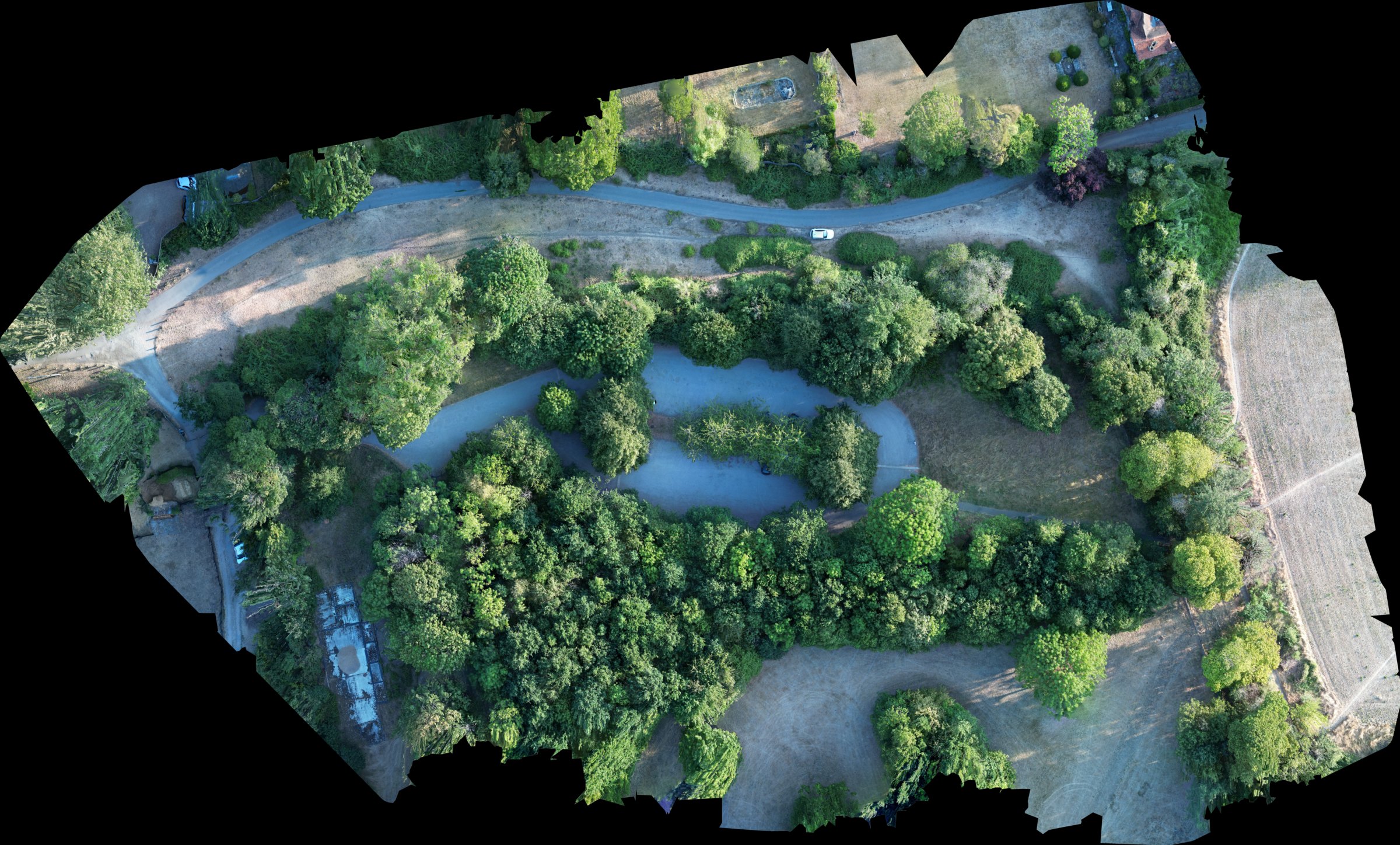
Demonstration capture — not client work.
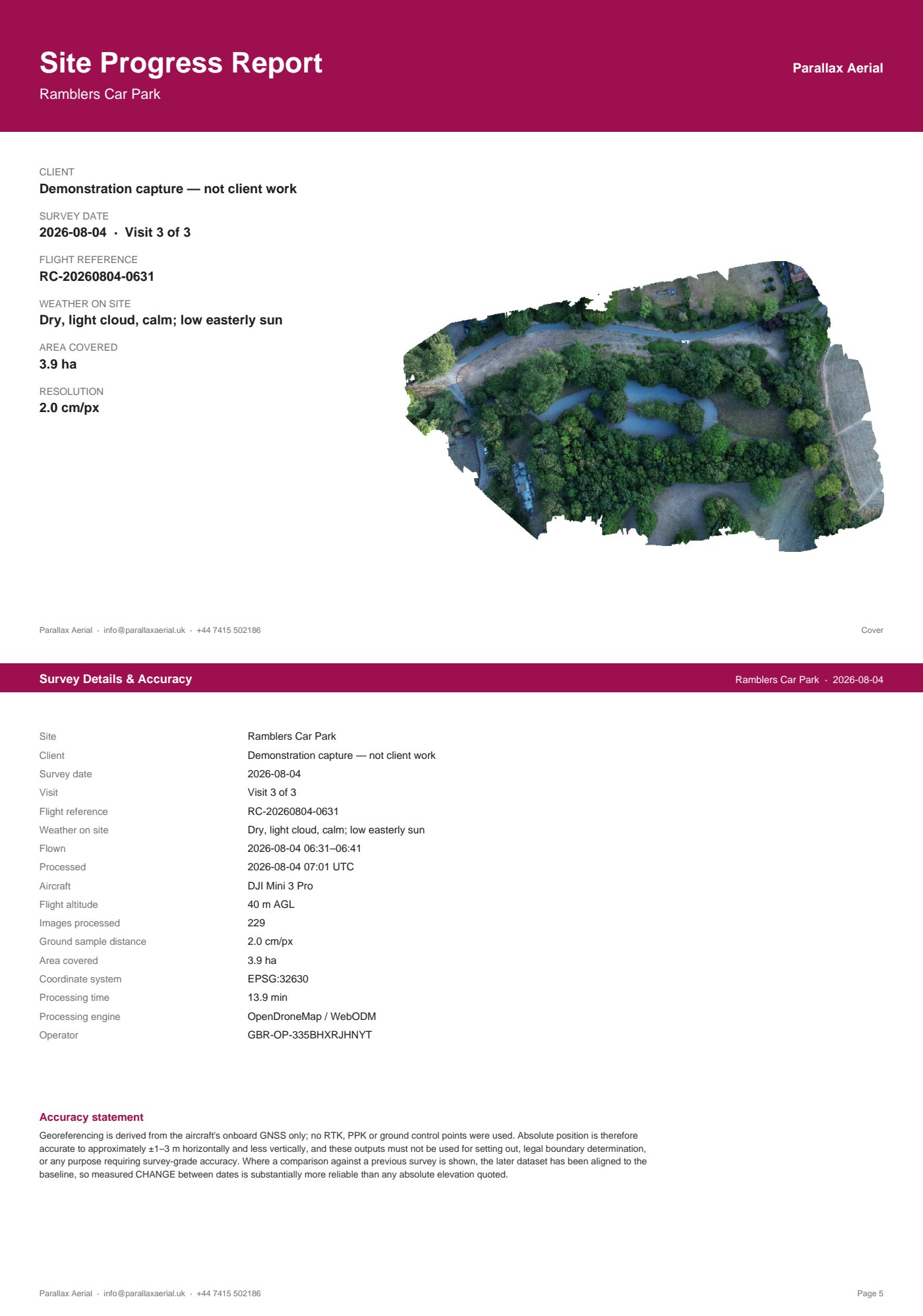
The full pack downloads from the homepage.
These are my own captures, flown on real sites to the same specification as a client brief — same aircraft, same saved mission, same pack at the end. Everything above is genuine output, not a mock-up.
How the work runs
- Brief. A short call: site, access, induction requirements, what the record is for (progress meetings, programme evidence, claims support, inspection).
- Quote. Fixed price in writing, per site, within one working day.
- Plan. RAMS supplied, airspace and permissions checked, flight window agreed with the site manager.
- Fly. A saved mission — identical waypoints, heights and camera angles every visit, so month three compares to month one.
- Process. In-house: orthomosaic, labelled stills, comparison against the previous visit.
- Deliver. PDF pack within 48 hours of a successful flight.
GVC qualified · CAA Operator ID GBR-OP-335BHXRJHNYT · £10m public liability · EC 785/2004 compliant
Coverage: Berkshire · Bucks · Slough–Maidenhead–M4 · Surrey · Herts · Greater London